The Geography of History: A Mexican Map with More Than Just States
Let me take you back to a time when a map was more than just a tool to get from point A to point B. A time when it was a symbol of power, tension, and, let’s be honest, a bit of geopolitical drama. This is not the story of an exotic vacation, nor is it an escape to a beautiful beach—this is the story of a country’s journey through time, a history shaped by borders, wars, and the maps that trace them.
Today, we’re talking about Mexico—specifically, the map of Mexican states and a chapter in history that continues to leave a mark. If you’re thinking this is just about geography, well, buckle up. It’s much more than that. It’s about the delicate and sometimes tense relationship between Mexico and its northern neighbor—the United States. It’s about the boundary lines that changed the fate of a nation. And, of course, it’s about the Mexican states that made history, but not in the way you might expect.
When we talk about the Mexican states on the map, we’re not just talking about colorful regions on a map, each with its own name and unique culture. We’re talking about something far more significant—territory that was fought over, won, lost, and, in some cases, handed over after a conflict that shaped both nations for generations.
A Map with a Story
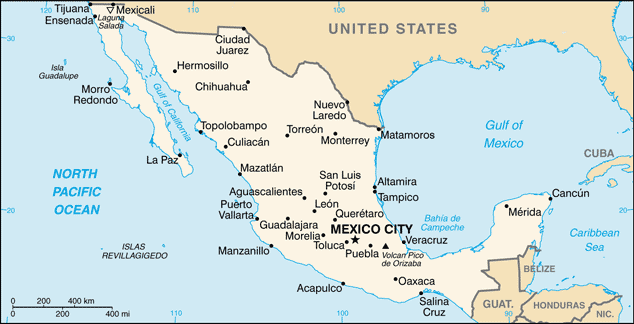
Let’s talk about the Mexican map for a second. It’s easy to look at the map of Mexico, with its jagged coastline, the vast stretches of desert, the lush forests, and the vibrant cities, and think that it’s just another beautiful place on Earth. But behind each region, there’s a story that’s filled with battles, politics, and the changing tides of history. Take a look at the map of Mexican states, and you’ll see a country that has been carved and reshaped through conflicts, treaties, and territorial disputes.
You’ve got your Baja California in the north, your Yucatán Peninsula in the southeast, and then all those states in between that each have their own history to tell. But, as we all know, maps aren’t just about the land—they’re about the story behind the land. And that’s where things get interesting.
The most dramatic chapter in the history of Mexico and its map occurred in the 19th century, when the United States and Mexico were embroiled in what’s now known as the Mexican-American War (1846-1848). It was a war over territory—specifically the vast expanse of land that the United States wanted to expand into, and Mexico was unfortunately in the way.
Now, you’re probably wondering, what does this have to do with the map of Mexican states? Well, let’s rewind. After the war, which Mexico unfortunately lost, a treaty was signed—the Treaty of Guadalupe Hidalgo. And that treaty didn’t just end a war; it changed the map of both Mexico and the United States forever.
The Land That Was “Acquired”
When the war ended, the United States found itself with a shiny new addition to its territory: land that was once part of Mexico. If you look at a map of Mexico today, you won’t see these lands listed as part of the country anymore. That’s because Mexico ceded vast regions, now known as the southwestern United States, to its northern neighbor. If you’re wondering where exactly this land is, just glance at the Mexican map with states, and you’ll notice a chunk missing from the north.
We’re talking about modern-day California, Nevada, Utah, Arizona, and New Mexico—states that were once firmly part of Mexico. If you look at the Mexican states map, you won’t see these states labeled in the same way. They were handed over, like a reluctant gift, in exchange for $15 million (that’s about $400 million today, adjusted for inflation). That’s a lot of money, but as history often shows us, money doesn’t always compensate for the loss of something as valuable as land and identity.
So, when we’re talking about the Mexican map today, let’s not forget that the map has changed—not just in the way it looks but in what it represents. The territory Mexico lost wasn’t just an empty space. It was land rich with resources, culture, and history. And for many Mexicans, those maps of the United States still represent a sense of loss, not just of land, but of identity.
The War That Redefined a Nation
But let’s step back for a second. How did this war even start? Why did it happen? Well, there were a lot of factors, but one of the biggest reasons was the expansionist belief in the United States, often called “Manifest Destiny.” This belief held that it was the God-given right of the United States to expand across the continent, from coast to coast, taking whatever land it needed along the way.
To the north, the U.S. was already eyeing Mexican territories like Texas, California, and the rich lands of the southwest. To Mexico, this was a direct threat to its sovereignty and territory. And so, the war broke out. For Mexico, it was a disaster. For the United States, it was an opportunity to fulfill its dream of becoming a continental power.
In hindsight, this conflict was one of the key turning points in the relationship between the two countries. It’s easy to point to the acquisition of land as a simple transaction. But behind that land change, there was a series of decisions, battles, and negotiations that permanently altered both countries’ futures.
A Bittersweet Gift
Let’s be clear: this wasn’t a simple case of one country winning and the other losing. Mexico wasn’t just handing over land like it was some kind of casual exchange. For Mexico, losing such vast territories felt like a betrayal—a reminder that political decisions can sometimes have long-lasting effects on a nation’s psyche.
While the United States looked at their shiny new territories and celebrated their newfound riches, Mexico was left to pick up the pieces. It wasn’t just the loss of land—it was the loss of pride, the loss of confidence, and the bitter realization that their country had been divided by an external force.
When you look at the map of Mexican states today, you might not see it at first, but the ghost of that loss still lingers. The map isn’t just a geographical tool—it’s a reminder of what was once and what could have been. The map tells a story of survival, of overcoming adversity, and of a country that, despite its challenges, has risen from the ashes time and time again.
The Maps We Make
So, what does this all mean for the map of Mexico today? Well, it means that when we look at any map, whether it’s of Mexican states or beyond, we must remember that the land is more than just lines and borders. It’s a history, a culture, and a testament to the resilience of the people who live there.
For the United States, the acquisition of land was a moment of triumph, but for Mexico, it’s a reminder of the struggles and sacrifices made by the generations before. Every map tells a story, and the story of the Mexican states is one of pride, loss, and ultimately, resilience.
In the end, maps are more than just tools of navigation—they are symbols of the history that shaped the world we live in. The map of Mexico, with its boundaries and its history, tells a story of a nation that has weathered the storms of time and continues to thrive despite the challenges it has faced. It’s a reminder that, no matter how much land changes hands, the spirit of a people remains unshaken.
And as we look at maps today, let’s remember: every boundary, every state, every line has a story. And those stories, if we choose to listen, can teach us more than we ever imagined.